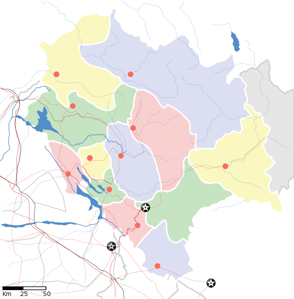
فائل:Himachal Pradesh locator map.svg

Size of this PNG preview of this SVG file: ٥٨٩ × ٥٩٩ پکسلز. ٻیاں قرارداداں: ٢٣٦ × ٢٤٠ پکسلز | ٤٧٢ × ٤٨٠ پکسلز | ٧٥٥ × ٧٦٨ پکسلز | ١,٠٠٧ × ١,٠٢٤ پکسلز | ٢,٠١٣ × ٢,٠٤٨ پکسلز | ١,٠٣٩ × ١,٠٥٧ پکسلز۔
اصل فائل (ایس وی جی فائل، ابعاد ١,٠٣٩ × ١,٠٥٧ پکسل، فائل دا حجم: ١٣٨ KB)
فائل دا تاریخچہ
کہیں خاص ویلے تے تریخ کوں فائل کین٘ویں نظردی ہائی، ݙیکھݨ کیتے اوں ویلے تے کلک کرو۔
| تریخ/ویلہ | تھمب نیل | پاسے | ورتݨ والا | رائے | |
|---|---|---|---|---|---|
| موجودہ | ٢٣:٠٦, ١٤ اپريل ٢٠٢٠ |  | ١,٠٣٩ × ١,٠٥٧ (١٣٨ KB) | C1MM | Reverted to version as of 08:30, 11 April 2016 (UTC) |
| ٢٣:٠٥, ١٤ اپريل ٢٠٢٠ |  | ١,٧٣٥ × ١,٧٦١ (١٢٧ KB) | C1MM | Standardized | |
| ١٣:٣٠, ١١ اپريل ٢٠١٦ |  | ١,٠٣٩ × ١,٠٥٧ (١٣٨ KB) | Snjsharma | Reverted to version as of 16:48, 4 June 2007 (UTC) | |
| ١١:٤٩, ١٤ مئی ٢٠١٣ |  | ٢,٠٠٠ × ٢,٠٣٥ (٨٥٤ KB) | Snjsharma | New Version. | |
| ٢١:٤٨, ٤ جون ٢٠٠٧ |  | ١,٠٣٩ × ١,٠٥٧ (١٣٨ KB) | Planemad | {{WikiProject_India_Maps |Title=Himachal Pradesh locator map |Description=Map of w:Himachal Pradesh with road and rail lines. |Source= |Date=June 2007 |Author=w:user:Planemad }} Category:WikiProject India State Maps |
فائل ورتݨ
اِیں فائل نال ہیٹھاں درج ورقہ مربوط ہے:
فائل دا کلجگ ورتاوا
ایہ ٻئے وکی ایں فائل کوں ورتیندن:
- ar.wikipedia.org تے ورتݨ
- ast.wikipedia.org تے ورتݨ
- as.wikipedia.org تے ورتݨ
- awa.wikipedia.org تے ورتݨ
- azb.wikipedia.org تے ورتݨ
- ساری مولاق
- سادهوپول
- جاوالی, هیماچال پرادش
- سیر قوباردهان
- مالانا, هیماچال پرادش
- سیمبال, هیماچال پرادش
- ماهوناق
- جایی (هیندوستان)
- جایدوی
- جاهو (هیماچال پرادش)
- راجپور داقالی
- ایچهی (هیندوستان)
- زاکاتخانا
- هیکیم, هیماچال پرادش
- پوبووال
- پراقپور
- هالر, هیماچال پرادش
- واشیشت, هیماچال پرادش
- قوپالپور, هیماچال پرادش
- دانپور, هیماچال پرادش
- دانکار ویلیج
- قالون (هیندوستان)
- دلان, هیماچال پرادش
- دارلاقات
- دانقوه خورد
- داده (هیندوستان)
- چیتکول
- ناور-والی
- ناونی (هیندوستان)
- چاونترا
- ناکو, هیماچال پرادش
- چاکی مود
- بیر, هیماچال پرادش
- بارواین
- کیبر (هیندوستان)
- تاشیقانق
- تاکسال
- کاردانق
ایں فائل دا ٻیا جگ ورتݨ ݙیکھو.